
Passenger Information & Experiences
We help people find their way 
Getting around mega cities like Cairo can be a challenge, especially with no reliable data out there. This is why, Transport for Cairo is working on making transit data available to everyone.
Besides the digital mapping, we work on creating various transit Maps, signage, wayfinding, travel guides & network information systems that help people navigate through the different transportation systems.


Network Information Systems
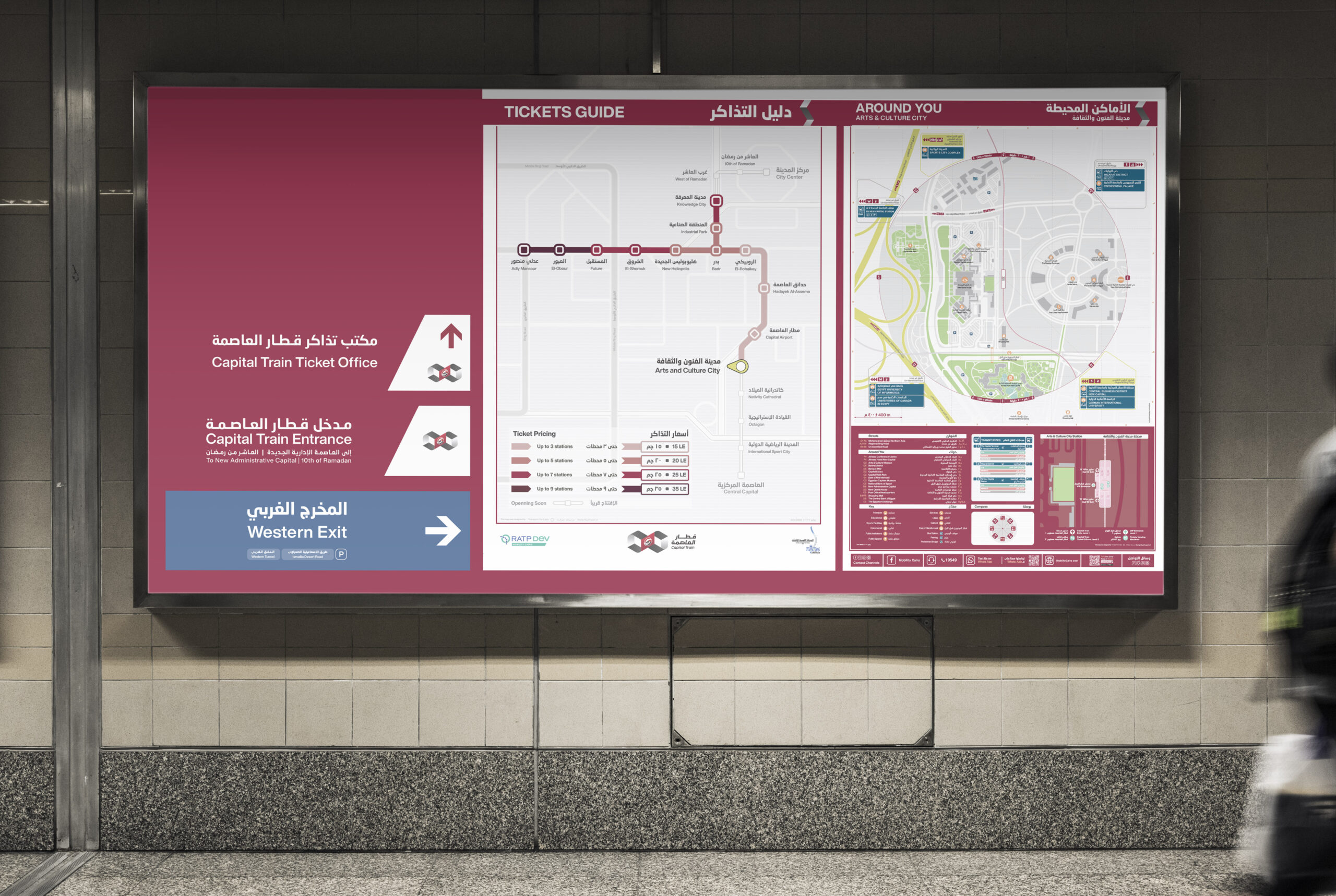
A typical passenger or network information system provides essential guidance to help users navigate the transit network with ease. While components may vary based on local context and facility requirements, standard stations should generally include the following:
Network maps shows an overview of the public transport lines. Those could include individual operators such as the metro or multimodal networks of different modes.
In 2021, Transport for Cairo redesigned the city’s first official underground network map under the rebranding and redeployment of Cairo Metro Line 3 through RATP-Dev Cairo (RDMC) had commissioned TfC.
Line Maps/Directional Signages highlight specific routes and directions inside vehicles or platforms for the users to navigate the systems easily.
In 2025, TfC supported RATP Dev in redesigning the cities local bus passenger information systemsby introducing clear wayfinding elements, including line maps & neighbourhood mapsA typical passenger or network information system provides essential guidance to help users navigate the transit network with ease. While components may vary based on local context and facility requirements, standard stations should generally include the following:
A typical passenger or network information system provides essential guidance to help users navigate the transit network with ease. While components may vary based on local context and facility requirements, standard stations should generally include the following: