Are you tired of waiting in traffic? Do you want to save time and money and leave your car behind? Do you want to start using public transportation but don’t know how? Are you operating a bus company and want to attract more commuters? Are you a developer who is working on transportation infrastructure and want to make it accessibile to more people when it is launched?
If the answer to any of these questions is a yes, then the first thing that is needed is available and accessible data! To be able to change a commuting behavior, you need to have sufficient data that allows people to understand the dynamics of the mobility system.
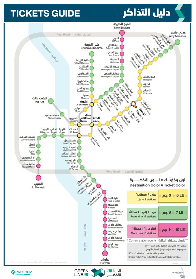
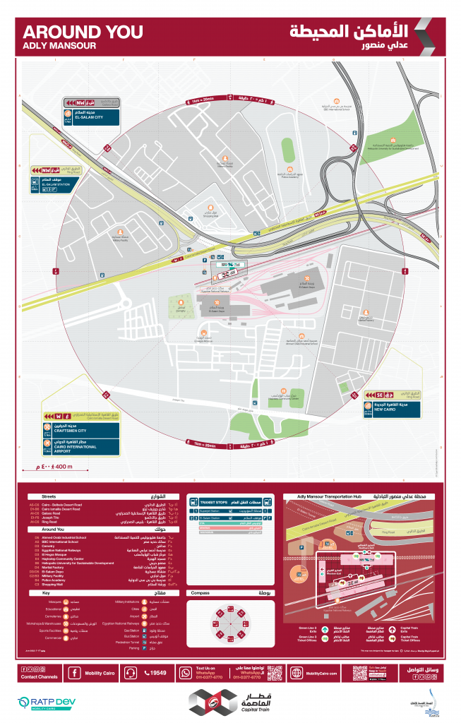
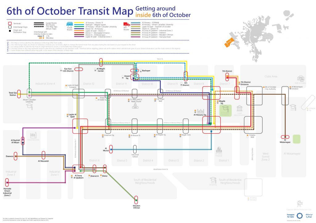
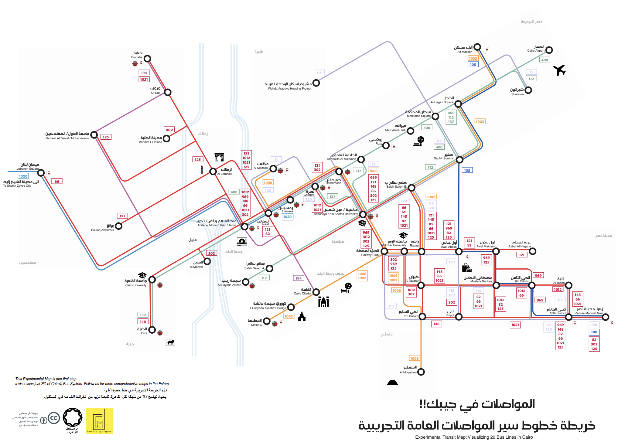
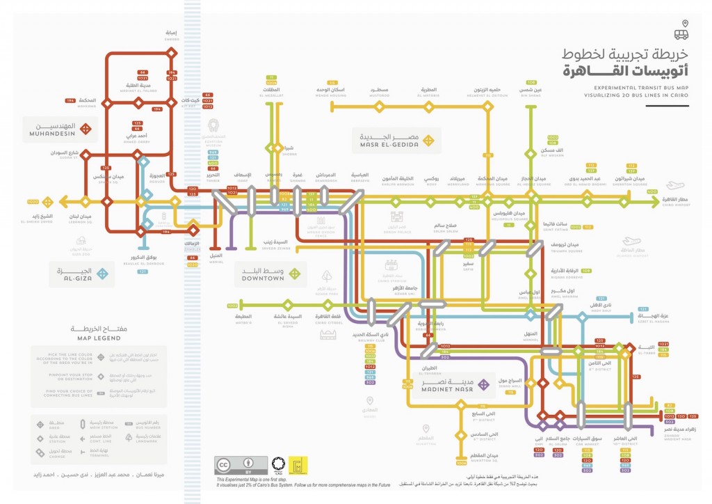
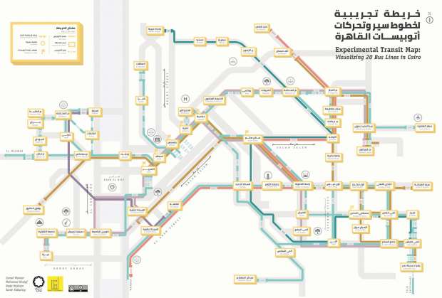
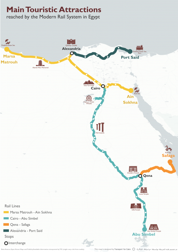
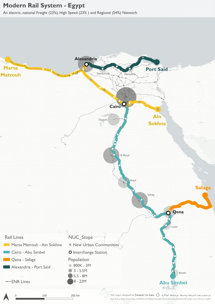
One of the oldest and most efficient means to achieve this, is to have access to adequate Passenger Information presented through transit maps, wayfinding and signage! PIS help you identify the coverage of the network, the places you can reach, the modes and routes you need to take to arrive at your preferred destination, as well as how to use and navigate within this complex system.
