Expo Live supports the Digital Cairo consortium as part of a cohort of projects and solutions from around the world whose solutions generate social and environmental value and are in line with Expo 2020 Dubai’s subthemes of Opportunity, Mobility and Sustainability. Expo Live will harness the convening power of a World Expo to demonstrate how innovations coming from all places and people can advance the pace of progress and inspire a more inclusive and prosperous future.
Expo Live supports the Digital Cairo consortium as part of a cohort of projects and solutions from around the world whose solutions generate social and environmental value and are in line with Expo 2020 Dubai’s subthemes of Opportunity, Mobility and Sustainability. Expo Live will harness the convening power of a World Expo to demonstrate how innovations coming from all places and people can advance the pace of progress and inspire a more inclusive and prosperous future.
The Digital Cairo project set out to map the formal and para-transit systems operating within the Greater Cairo Region ‘GCR’ and aggregate those systems within a single multi-layer network. The objective was to create a focal point of understanding, assessing and potentially developing urban transport projects and policies for the future. In doing so, it is tackling some of the key challenges surrounding the (1) invisibility of para-transit systems as functioning transit networks used in conjunction with formal modes, (2) the lack of strong data collection at the city scale and the need to (3) localize the process of producing standardized, open and comparable data.
Over the course of 2017-2018, the mapping successfully comprised data on 216 routes that form the public transport network servicing the following geographic scopes:
All intra-city public transport services originating and ending within six New Desert Cities (NDC): El-Sheikh Zayed City, 6th of October City, New Cairo, El-Obour City, El-Shorouk City, Badr City.
All inter-city public transport services originating within an NDC’s and ending in a different NDC.
All inter-city public transport services originating within an NDC’s and ending within the boundaries of Cairo.
This strategy was preferred over alternatives as it allowed aiming for a hundred percent coverage of the network of all operating modes of transport within the NDC’s. Over the course of 2018 – 2019 Digital Cairo aims to resume mapping of the rest of the Greater Cairo Region.
This data is created by Transport for Cairo ’TfC’ with DigitalMatatus and Takween for Integrated Community Development, under the Digital Cairo Project supported by ExpoLive 2020.
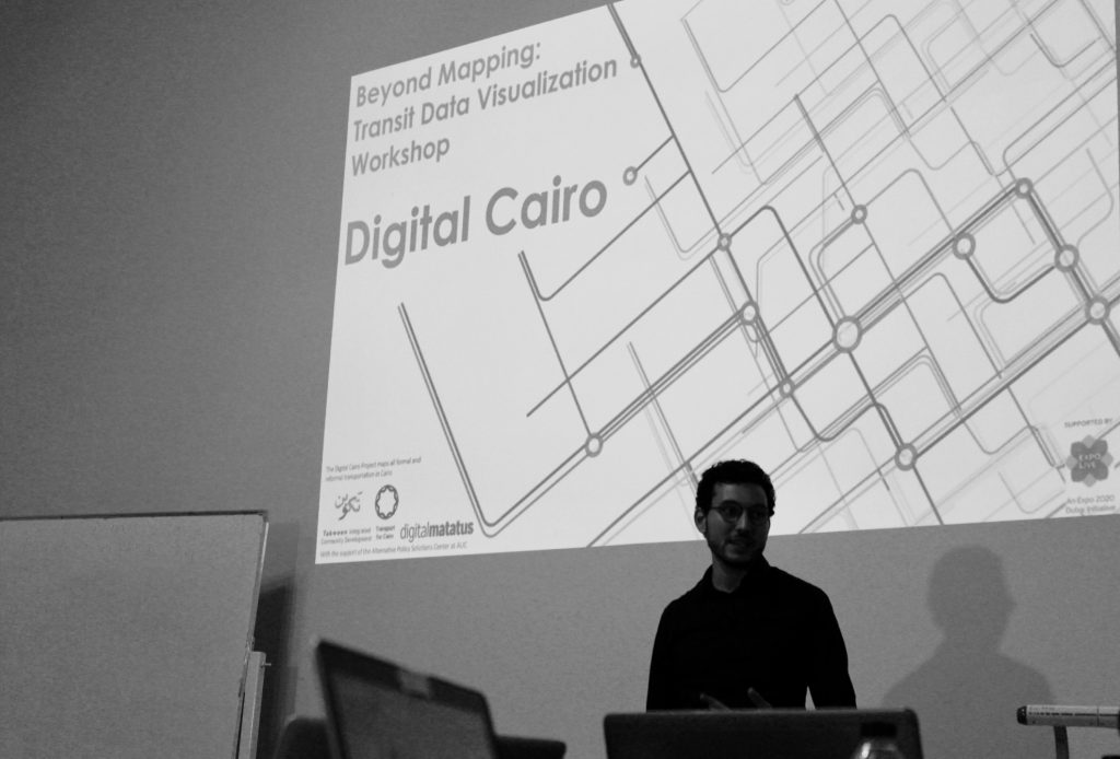
Beyond Mapping Workshop
AUC, Cairo, Egypt
August 27, 2018 - August 28, 2018
How 4 teams of young professionals uncovered useful insights on Cairo’s New Desert Cities using our newly collected data
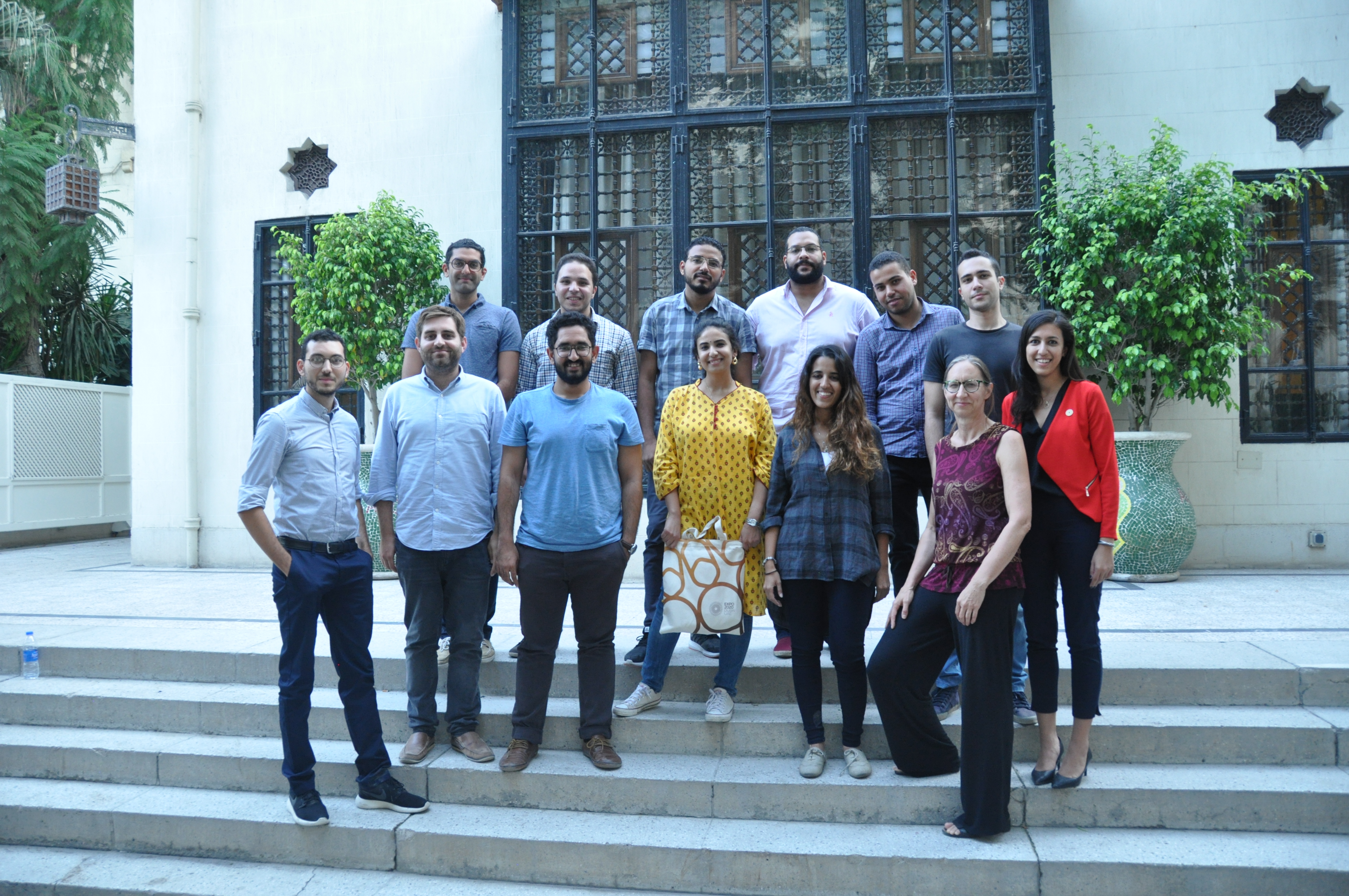
TfC’s recently collected data was used to lead a data visualization workshop in Cairo in the American University in Cairo’s Tahrir campus in late August, 2018. During the 3-day workshop, the teams learned about data visualization techniques, the context of the data, and its sociological implications and biases.
The Data
As part of Digital Cairo, TfC collected data on 345 processed trips and 1300 stops across the Greater Cairo Region. More specifically, we covered all intra-city public transport within six key New Desert Cities. All modes were covered, including formal and informal modes because we believe the solution lies in multi-modal inclusive transport planning. As always, the data is released as Open Data.
Participants were invited to join after a rigorous application process a month in advance. The competition was fierce and only the top 20% were offered spots in the workshop. They were given access to our data along with 4 presentations covering:
the Egyptian transport context and history by Takween’s, Dina Khaleel
the basics of data visualization by TfC’s own MIT-alum co-founder, Adham Kalila
the process of data collection and its potential by ourown director, Mohamed Hegazy
the socio-economic implications and biases of the field by Takween’s Salwa Salman
The Results
The teams received ongoing support from TfC and their output was reviewed by our friends at MIT. Each team was asked to present their visualizations along with a description of their motives and their findings. The outputs in detail can be viewed here:
We found that Team 3’s outputs were the most easily readable and the most impact. Their visualization can quickly show residents of four parts of the city how far they can commute using any combination of public transportation and walking. Below is the visualization for origins at New Cairo. For other origins and more details, click on Team 3 above.
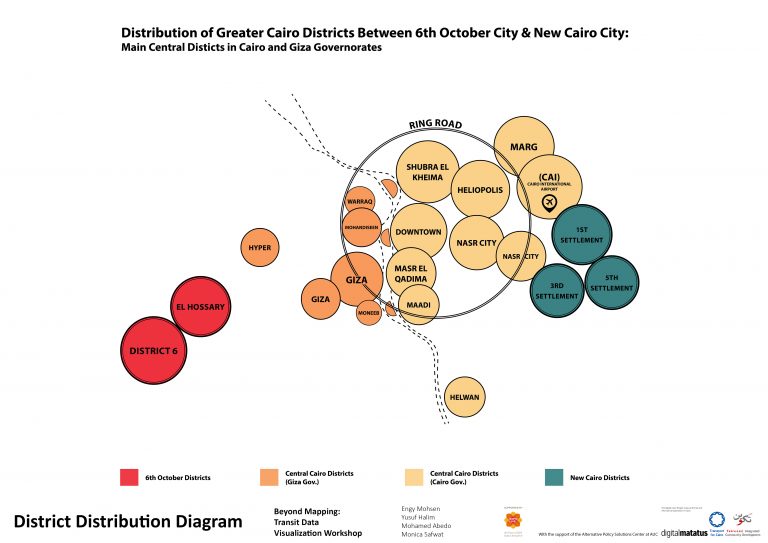
Team 1 - Comparing the connectivity of 6th of October and New Cairo to Central Cairo
Problem Definition
Demand for housing in the New Urban Communities is increasing but the majority of people still work in Cairo’s central districts. Daily commutes between 6th of October City and New Cairo City to the rest of the Greater Cairo Region are now essential for a lot of people which urges the need for a well-connected transit network to both New Urban Communities.
Findings
New Cairo City is the most connected new urban community to other GCR districts.
Shobra El Kheima district is the most connected GCR central district to the other two new urban communities.
6th Of October City in general and El Hossary Square in particular needs more local bus routes to other GCR central districts since it currently depends on direct microbus service. This will certainly create more diversity in transit options.
Visuals
Team Members
Engy Mohsen
Yusuf Halim
Mohamed Abedo
Monica Safwat
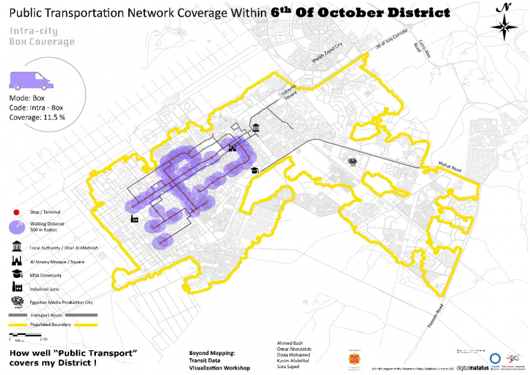
Team 2 - How well does public transit cover my district?
Problem Definition
Like other districts in the Greater Cairo Region, 6th of October commutes involve both formal and informal modes of transport covering both intra-city and inter-city destinations. Although 6th of October enjoys a variety of public transportation modes, TfC’s data collection reveals that they are not extensive enough to cover all the inhabited areas.
Findings
The produced visualized maps unveil several patterns of the public transport network’s coverage and help examine the efficiency of the transit system within the district. It is observed that the transit system is focused on the district’s central axis, and that there is a dense overlapping of intra/inter-city transit systems, with limited to no coverage for most of the rest of the neighbourhoods. The outcome is that less than a quarter of the populated area of 6th of October district is covered with public transport service when a radius of 500 m from stops is used. Accordingly, commuters rely on private cars, taxis, and tuk-tuks to reach their uncovered destinations.
Visuals
Team Members
Ahmed Badr
Omar Aboutaleb
Doaa Mohamed
Karim AbdelAal
Sara Sayed
Team 3 - Which new community provides the fastest access to central Cairo's work opportunities using public transit?
Problem Definition
Despite the establishment of New Urban Communities in the easter and western deserts of Cairo, residents must still commute to central Cairo to reach many services and jobs. These daily commuting trips represent forms one of the main criteria that affect the selection of which neighbourhood to live in. As work occupies a big portion of our daily lives, time spent in commuting to work is valued highly by most people
Goal
We developed a visualization that shows the geographic extent of the Greater Cairo Region which can be reached within a 2 hour commute from the main hubs of four New Desert Cities. This can help residents choose the most suitable place to work from their places of residence depending on the amount of time they would like to spend on the Home-Work trip
Visuals
Team Members
Mahmoud Tharwat
Sara Ali
Moataz Mahrous
Ibrahim Abdou
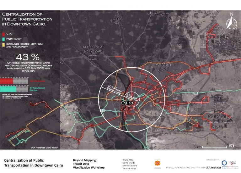
Team 4 - Centralization of public transportation in downtown Cairo
Problem Definition
We believe that traffic jams in downtown Cairo are a matter of political, geographical, and economic strategies adopted by authorities throughout the last few decades. A citizen going from point A to point B using public transportation in Greater Cairo may have to pass through downtown taking numerous Cairo Transport Authority (CTA) buses instead of using a different route that may be more direct and time-saving.
Findings
Our study identifies the portion of CTA routes passing through downtown in comparison to paratransit. Considering downtown Cairo with a 2 km circle from Ramses Square, we found that paratransit modes of transport offer 7 routes in comparison to 24 routes offered by the CTA. However, when the radius of the circle is extended to 10 km to include regions representing Central Cairo, we found that 50 paratransit routes exist compared with 22 CTA routes.