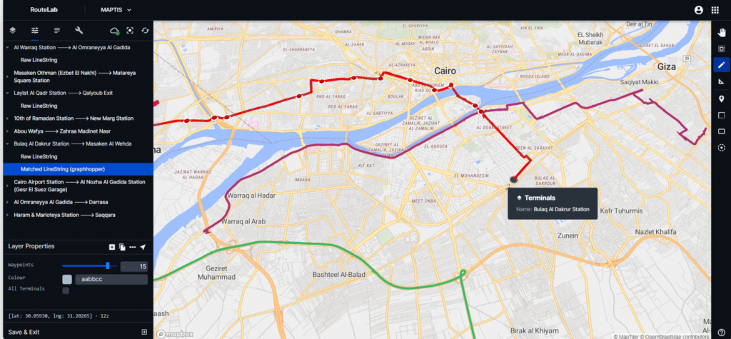
Collecting and managing mobility data of large cities is challenging. RouteLab digitizes and streamlines the processes we have developed over years of informal transit mapping.
A comprehensive, evolving cloud computing platform provided by TfC to enable the development of data-driven solutions to complex urban mobility problems
Efficient field research mobilization. Up to 75% reduction in data collection costs
Quick and easy data cleaning, validation and aggregation
Derive insights from videos and CCTV
Export data in standard formats including GTFS
Plan
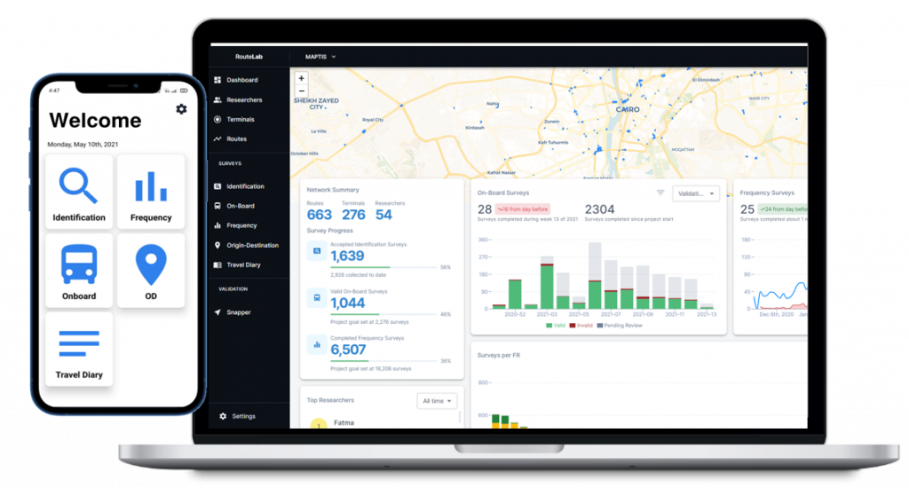
RouteLab Dashboard is a fully-fledged field research project management tool.
Exert full control over geographic and temporal sampling and follow up on field research progress in real-time.
Survey
Observer mobile app allows for automated assignment of field researchers to tasks based on pre-defined sampling.
Quality assurance techniques such as geo-fencing & live-tracking.
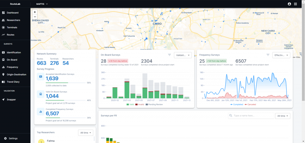
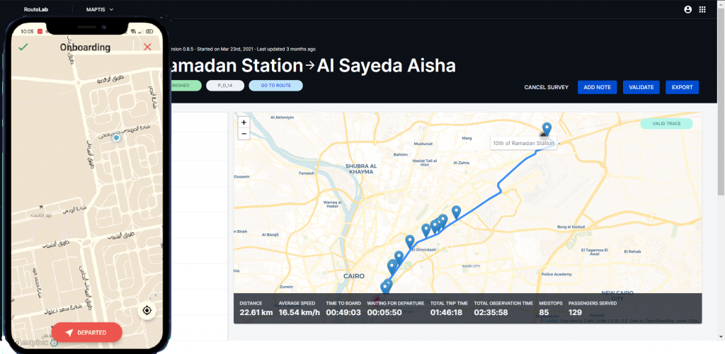
Process
Clean and validate incoming raw data.
Export data easily into GIS & GTFS formats.
Automate Section Counts
Lens module is built on a machine learning model that’s adaptable to all kinds of context-specific classified section counts.
The tool can take basic camera or CCTV video feeds as input.
Transforming African Paratransit
We help African cities envision and build sustainable mobility systems that make a distinctive and lasting impact on economic growth and quality of life in urban areas.
5 African Metropolitans Mapped
Interested in scaling data collection for your city?