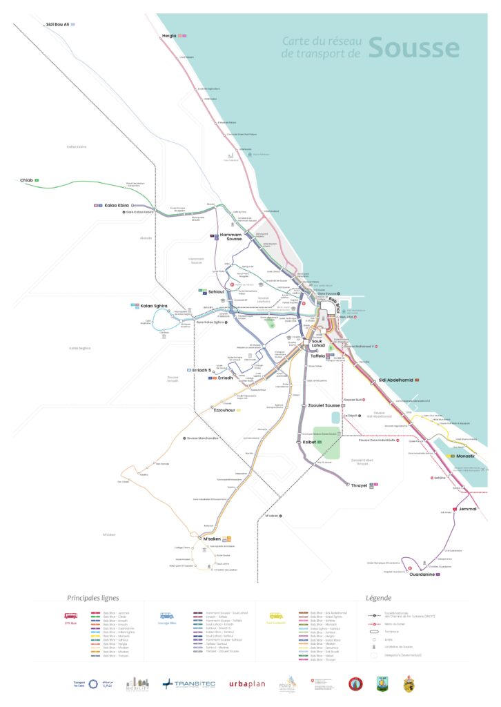
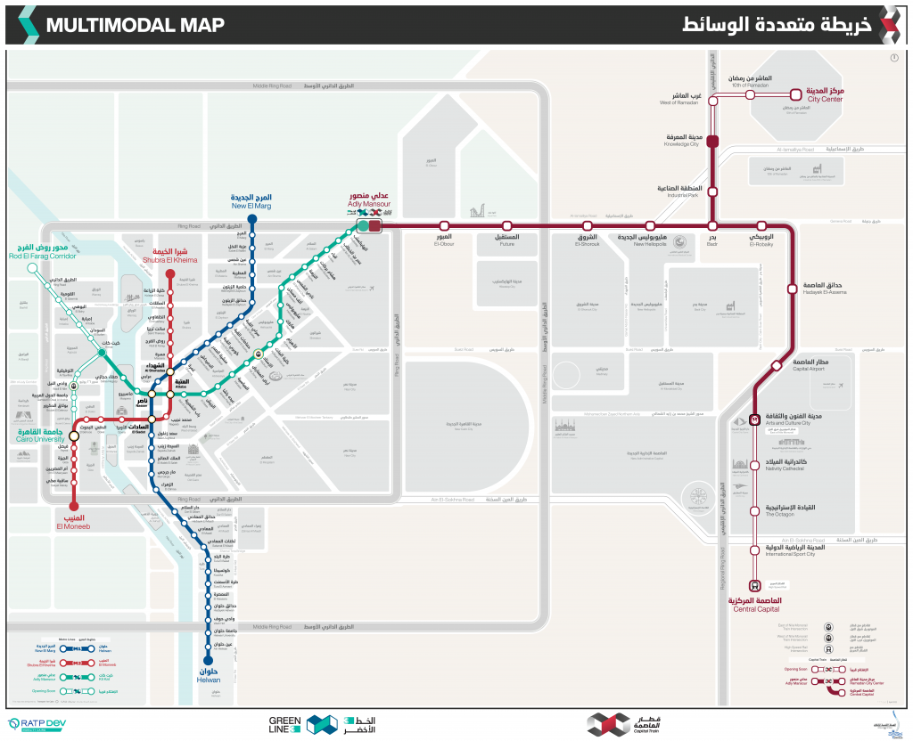
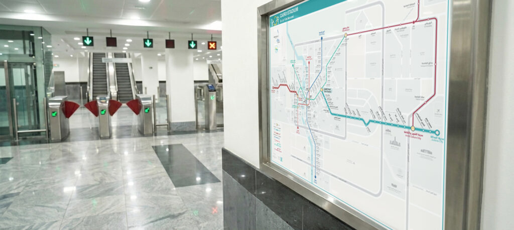
Maas & Journey Planning

Design and implement Passenger Information Systems (PIS) that make multimodal travel simpler, faster, and more reliable for users. Our work integrates data from multiple transport providers—formal, informal, and shared mobility—into unified journey planning tools that can be accessed via web, mobile, and in-station displays.

COP 27 Travel Guide Booklet

This project aims to ease the mobility of delegates, attendees, staff and personnel of the COP27, but also acts as an initiative to support the Sharm Green City Project and in branding Sharm El Sheikh to be an environmentally sustainable tourist destination. The travel guide booklet included: Background/incentive information From/to and within COP27 Venue Getting

COP 27 Travel Guide Booklet Read More »

Capital Express (LRT) Maps

The project is to create LRT’s Maps with the following objectives: Provide a complete map design package that covers all potential use cases; provide a user-friendly, bilingual passenger information experience to serve the diversity of potential passengers; highlight the integration with Green Line 3 and potential other public transport services to attract more ridership including

Capital Express (LRT) Maps Read More »

Mwasalat Misr Map

Mwasalat Misr contracted TfC to provide a schematic map for their bus routes and interchange options within their network and with Cairo’s metro lines. We helped with choosing best location for their stops network, and we produced GIS and GTFS for those lines was used by MM in their journey planning app.

Mwasalat Misr Map Read More »