Electric Bus Demonstration Project: Detailed Planning and Design Study for Cairo Transport Authority (CTA)
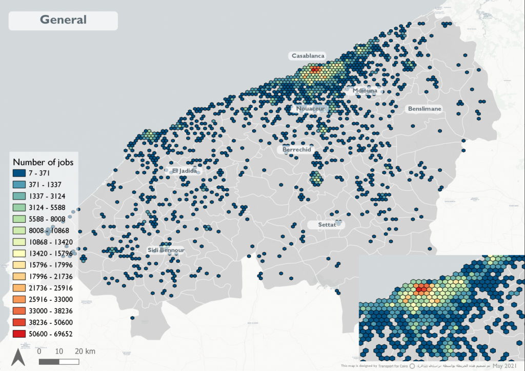
– Themes Country Client The project aims to implement E-Buses in Cairo and provide valuable lessons on their operational requirements, with a long-term objective to scale-up e-Bus deployment. Assessment and market briefing on e-mobility, with emphasis on public transport services Propose a set of service and operational design alternatives for e-bus operation Support CTA to […]