Visualisation

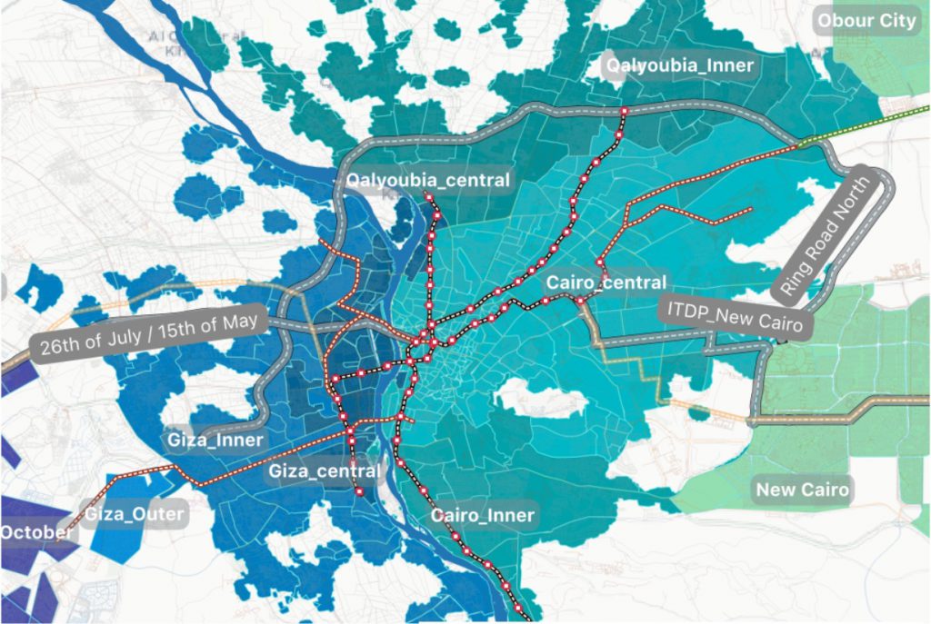
Transform complex datasets into clear, engaging visual formats (maps, charts, dashboards) to support analysis, communication, and decision-making in transport projects.

Digital Transport for Africa – Technical Support for Cities to go Beyond Mapping

DigitalTransport4Africa with funding from French Development Agency (AFD) and leadership of World Resources Institute (WRI) have tasked Transport for Cairo (TfC) to provide technical support for selected African cities to go “Beyond mapping”. The exercise consisted of (a) assessing and choosing an African city to provide technical support, and (b) define the activities and outputs […]

Digital Transport for Africa – Technical Support for Cities to go Beyond Mapping Read More »

Capital Express (LRT) Maps

The project is to create LRT’s Maps with the following objectives: Provide a complete map design package that covers all potential use cases; provide a user-friendly, bilingual passenger information experience to serve the diversity of potential passengers; highlight the integration with Green Line 3 and potential other public transport services to attract more ridership including

Capital Express (LRT) Maps Read More »

Using New Urban Mobility Data in Accessibility Analysis (NUMO)

Accessibility analysis has gained importance in transport and land use integration research, planning and policy making. The study focuses on the following objectives and applies them to four different cities: Incorporating realistic travel times in the analysis Integrating NUM modes in the analysis Operationalizing equity parameters into the analysis framework

Using New Urban Mobility Data in Accessibility Analysis (NUMO) Read More »

Greater Cairo Region Mobility Assessment and Public Transport Improvement Study

The study proposes public transport investment projects to improve efficiency and environmental footprint of the region’s economy. It will also address inclusiveness challenges by providing safer, more reliable, and more comfortable experience for all and especially women, vulnerable groups, and people with special needs. 

Greater Cairo Region Mobility Assessment and Public Transport Improvement Study Read More »

Multimodal Transport Strategy for the Greater Cairo Region

The WB contracted TfC to choose the 3 optimal corridors for public transport interventions and ideal locations for 10 Park-and-Ride facilities. TfC conducted a metropolitan level analysis of accessibility across 1613 places in the GCR at the present, and compared it with the expected impact of all alternatives to arrive at the most impactful options. This

Multimodal Transport Strategy for the Greater Cairo Region Read More »