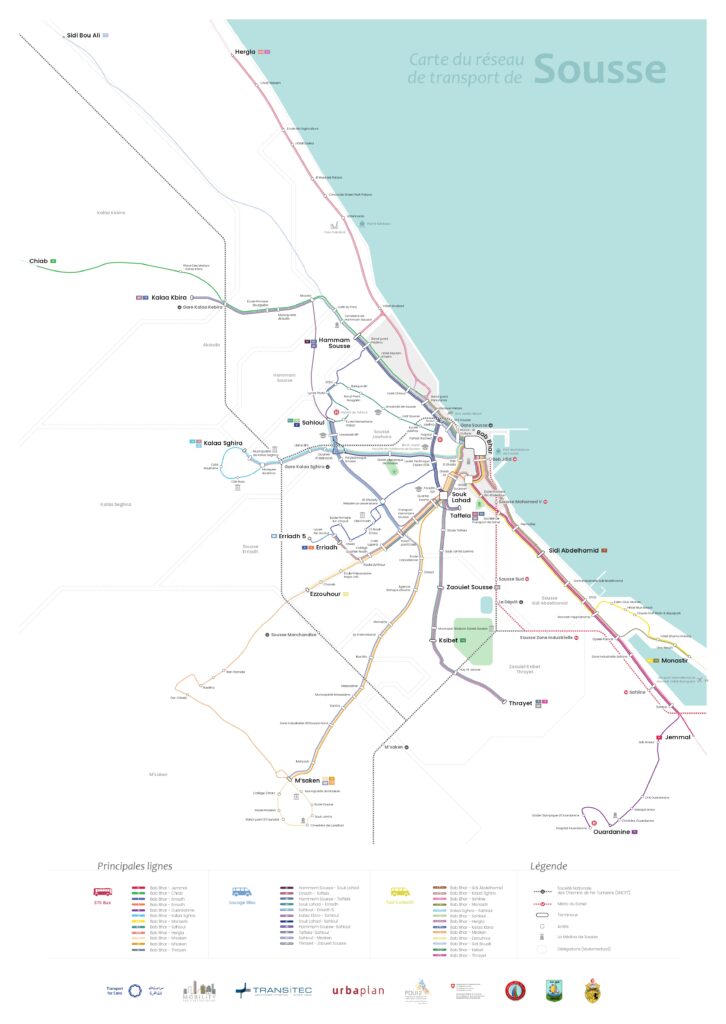
Sousse Tunisia Transit Map
← Back to publication Menu Client: Download Map Premium Banner
Sousse Tunisia Transit Map Read More »
← Back to publication Menu Client: Download Map Premium Banner
Sousse Tunisia Transit Map Read More »
– Themes Country Client Read more Technical Assistance for mobility data creation and production for the Observatory of Urban Mobility (AMUGA) Design of Multimodal Station Network Maps – The New Capital Monorail Data Collection for the Restructuring of the Greater Sousse Bus Network Joining Knowledge forces for Sustainable Transport policies in Africa
Design of Multimodal Station Network Maps – The New Capital Monorail Read More »
← Back to publication Menu Client: Download Premium Banner
Riyadh Bus Network Pilot Project: Information and Mapping Read More »
– Themes Country Client Check the publication here: Read more Joining Knowledge forces for Sustainable Transport policies in Africa Global NDC Template for Popular Transport Riyadh Bus Network Pilot Project: Information and Mapping Recommendations for Transport in Egypt’s Nationally Determined Contribution
Riyadh Bus Network Pilot Project: Information and Mapping Read More »
← Back to publication Menu Client: Download Map Premium Banner
Lusaka Transit Map Read More »
← Back to publication Menu Client: Download Publications Premium Banner
COP 27 Travel Guide Read More »
← Back to publication Menu Client: Download Publications Premium Banner
Using New Urban Mobility Data in Accessibility Analysis – NUMO Read More »
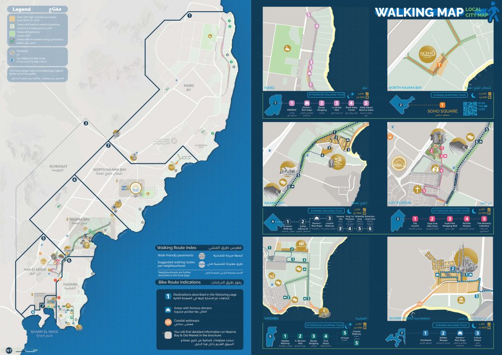
– Themes Country Client This project aims to ease the mobility of delegates, attendees, staff and personnel of the COP27, but also acts as an initiative to support the Sharm Green City Project and in branding Sharm El Sheikh to be an environmentally sustainable tourist destination. The travel guide booklet included: Background/incentive information From/to and
COP 27 Travel Guide Booklet Read More »
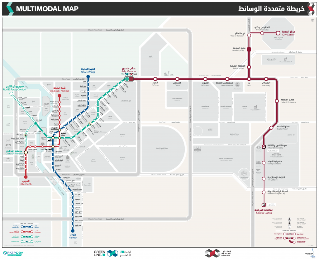
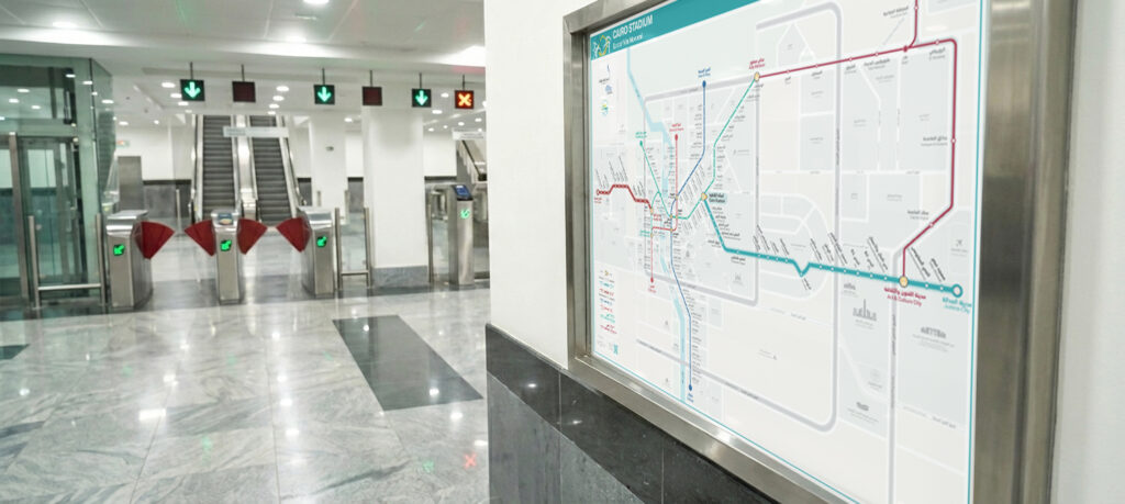
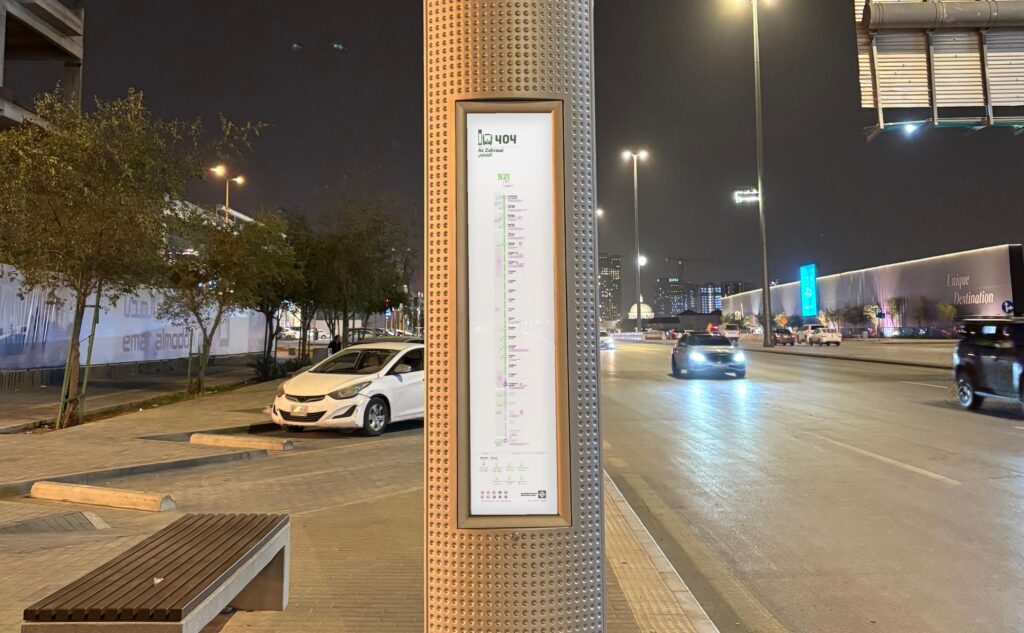
– Themes Country Client The project is to create LRT’s Maps with the following objectives: Provide a complete map design package that covers all potential use cases; provide a user-friendly, bilingual passenger information experience to serve the diversity of potential passengers; highlight the integration with Green Line 3 and potential other public transport services to
Capital Express (LRT) Maps Read More »
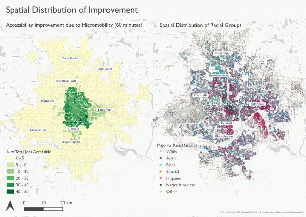
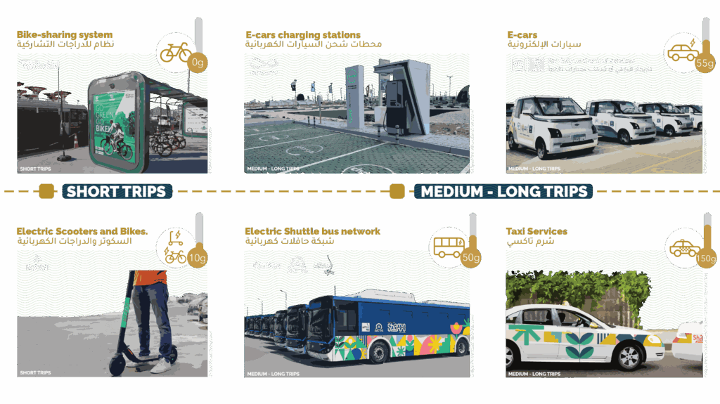
– Themes Country Client Accessibility analysis has gained importance in transport and land use integration research, planning and policy making. The study focuses on the following objectives and applies them to four different cities: Incorporating realistic travel times in the analysis Integrating NUM modes in the analysis Operationalizing equity parameters into the analysis framework Check the publication
Using New Urban Mobility Data in Accessibility Analysis (NUMO) Read More »