Active Mobility, Data, Surveys & Modelling, GIS/GTFS & Databases, Informal & Paratransit Integration, Strategic Transport Planning & Scenarios, System Mapping & Data, Transport Policy & Strategic Planning, Travel Surveys & Field Data, Visualisation
report
September 5, 2019
Client:
World Bank
Multimodal Network Planning, Identification of High Capacity Bus Corridor and Park and Ride Facilities
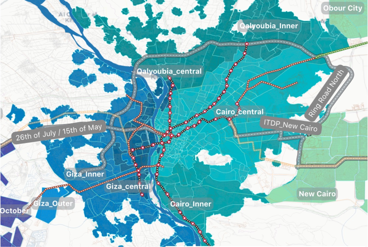
Multimodal Transport Strategy for the Greater Cairo Region: The lives and experiences of people are at the heart of urban life - and of this study - which assesses the multimodal travel options available to citizens at present, and in the future, to identify the optimal locations of three future high capacity transit corridors and 10 park and ride facilities.
Description of services:
• Developed a highly granular population and job distribution datasets for the GCR
• Comprehensive Accessibility Analysis of the GCR
• Analysed ride-hailing data to understand user behaviour
• Analysed travel time, and variation thereof, for 21 corridors using a Big-Data approach
• Identification of 3 key demand corridors (for buses and/or BRTs) linking the New Urban Communities to Central Cairo.
• Identification of 10 potential park-and-ride sites in the New Urban Communities.
• Proposed recommendations to enhance urban mobility and usability of the 3 recommended corridors; including [A] principles to approach integration of the existing informal transit with the planned formal system; [B] strategic recommendations to promote walking and [C] possibility of a bicycle network as a complementary feeder mode
• Modelling of future infrastructure to assess future accessibility; and optimise transport interventions for accessibility
• Proposed recommendations to enhance multimodal use of the public transport network in the GC